Antique Maps
Artemis has an interesting collection of antique maps by well known historical cartographers.
Antique Australian and World maps available.
Cartographers
John Tallis: (1817-1876) English cartographic publisher. His company, John Tallis and Company, published views, maps and atlases in London from about 1838 to 1851. Highly prized for his ornamental maps showing decorative borders, indigenous people and regional scenes.
John Bartholomew: Junior(1831-1893) Scottish cartographer. Best known for his development of colour contouring which represents altitudes on a graduated colour scale – areas of high altitude in shades of brown and areas of low altitude in shades of green.
John Thomson: (1777-1840) Scottish cartographer from Edinburgh, celebrated for his 1817 “New Gerneral Atlas – a collection of maps and charts, delineating the natural and political divisions of the empires, kingdoms, and states in the World. Constructed from the most authentic voyages and travels.”
Showing all 21 results
-
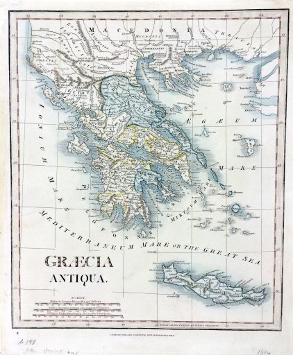
Ancient Greece
$155.00 AUD Read more -
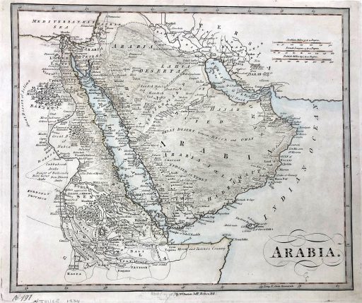
Arabia
$155.00 AUD Add to cart -
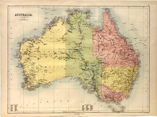
Australia
$350.00 AUD Read more - Sale!
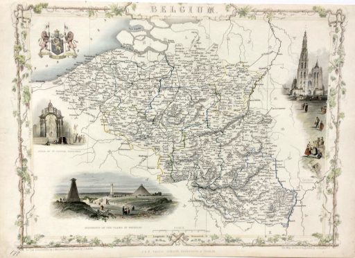
Belgium
Original price was: $195.00 AUD.$156.00 AUDCurrent price is: $156.00 AUD. Add to cart - Sale!
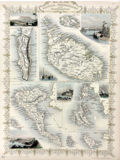
British Possessions of the Mediterranean
Original price was: $195.00 AUD.$156.00 AUDCurrent price is: $156.00 AUD. Add to cart -
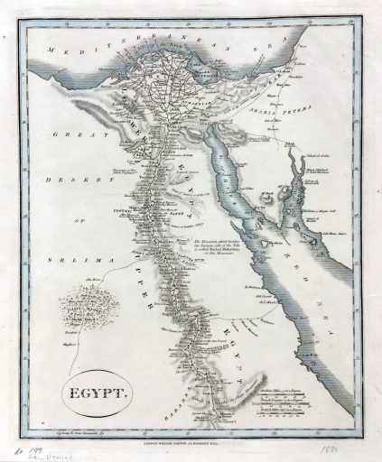
Egypt
$155.00 AUD Add to cart -
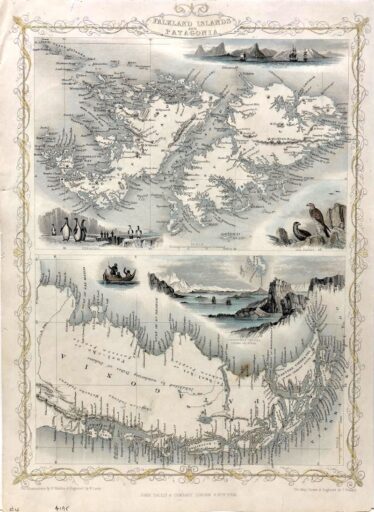
Falkland Islands and Patagonia
$195.00 AUD Add to cart - Sale!
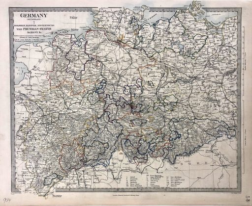
Germany
Original price was: $140.00 AUD.$112.00 AUDCurrent price is: $112.00 AUD. Add to cart - Sale!
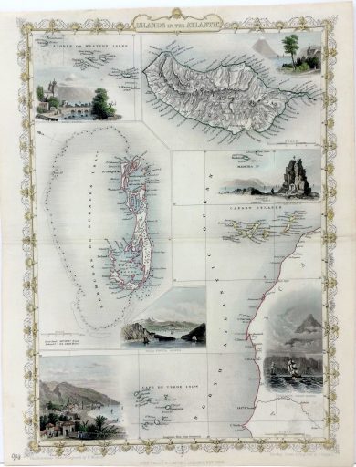
Islands of the Atlantic
Original price was: $150.00 AUD.$120.00 AUDCurrent price is: $120.00 AUD. Add to cart -
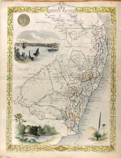
New South Wales c1851
$395.00 AUD Add to cart -
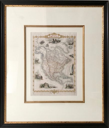
North America
$795.00 AUD Add to cart - Sale!
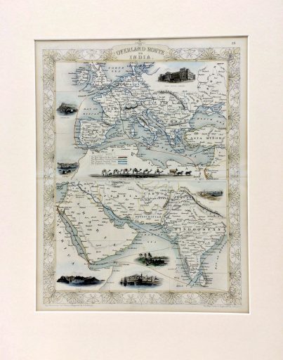
Overland Route to India
Original price was: $425.00 AUD.$350.00 AUDCurrent price is: $350.00 AUD. Add to cart -
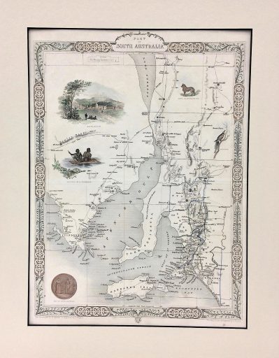
Part of South Australia
$425.00 AUD Add to cart -
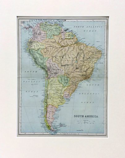
South America
$200.00 AUD Add to cart -
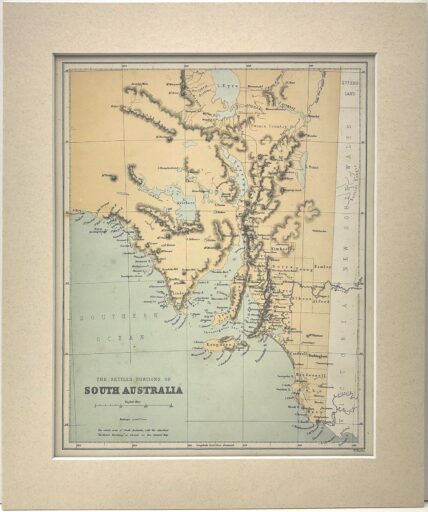
South Australia
$175.00 AUD Add to cart -
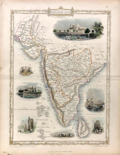
Southern India
$395.00 AUD Add to cart -
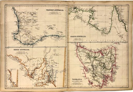
States of Australia – WA, SA, TAS, North Australia
$250.00 AUD Add to cart -
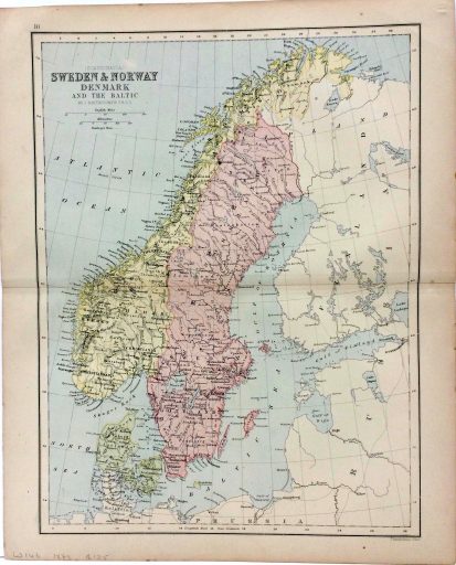
Sweden & Norway
$125.00 AUD Add to cart -
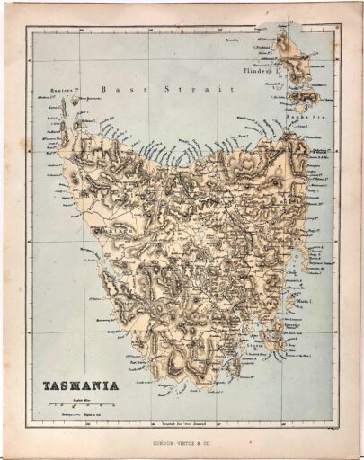
Tasmania
$150.00 AUD Add to cart -
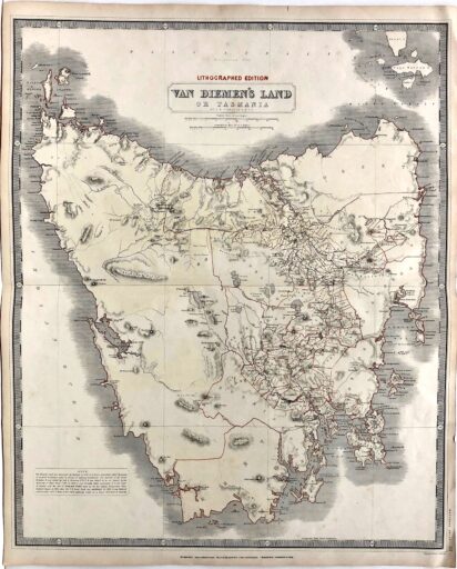
Van Dieman’s Land
$350.00 AUD Add to cart -
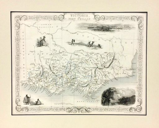
Victoria or Port Phillip
$425.00 AUD Read more